Object territory: Australia.
Average density of scanning: 466,5 points/sq.m.
Performance specifics:
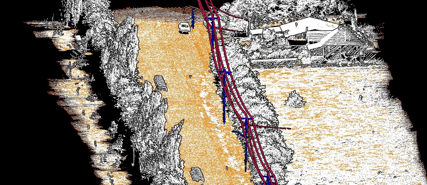
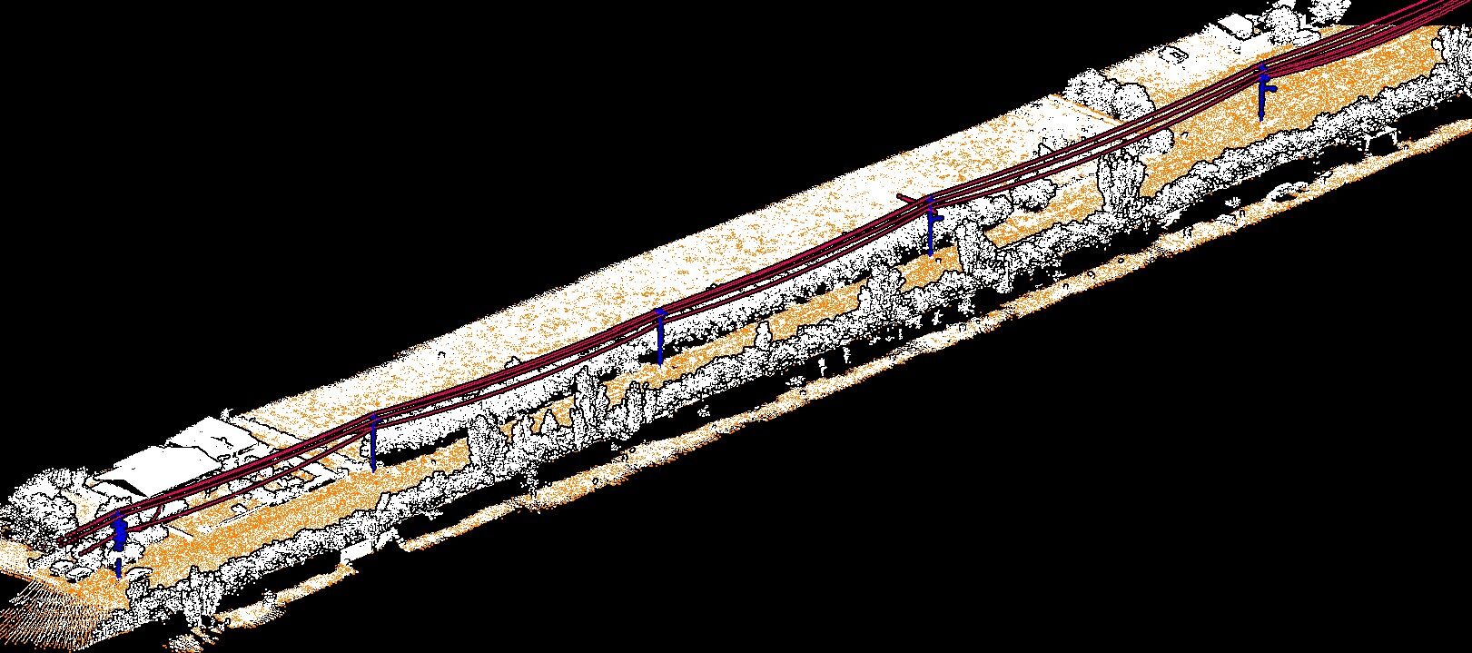
Classification:
1. Unclassified
2. Ground
7. Low Points / Noise
14. Wire
15. Poles
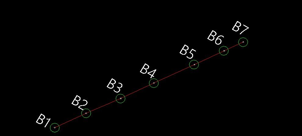
Site map:
- Pole locations
- Pole numbers
- Centreline of conductor
- Chainages at pole locations
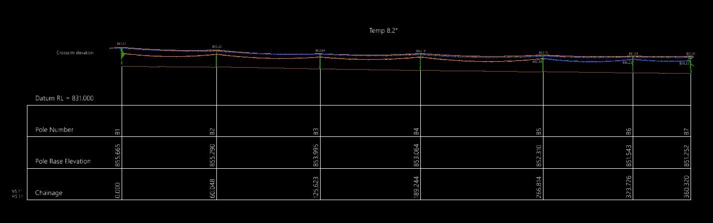
Longitudinal section:
- Chainage
- Pole base elevation
- Pole number
- Crossarm elevation(s)
- Profile view of the pole (points only are fine)
- Polyline showing each conductor
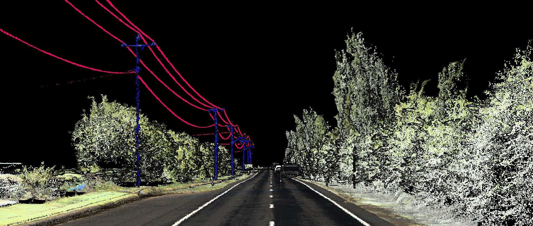
Problem and task.
- Data Source: UAV LiDAR scanning
- Input: Raw point cloud
- Challenges & Tasks:
Objective. The goal of the project is to process a point cloud to create an accurate terrain map and a longitudinal section of the power transmission line for analyzing wire sag depending on temperature and determining all parameters of poles for installation. Based on the point cloud data, the following will be generated:
- Site map containing the exact location of poles, their numbering, coordinates, and the central line of the wires, allowing for an understanding of the spatial organization of the power transmission line.
- Longitudinal section that defines the base heights of the poles, crossarm elevation, and the pole profile, providing a detailed representation of the vertical parameters of the line. The longitudinal section also includes data on the cable sag angle between poles, the absolute and relative elevation of the poles, distances between poles, and cable lengths.
1. Data Accuracy:
-
- Use of precise coordinates and geodetic data.
- A unified coordinate system for all data: WGS84 UTM55S.
2. Site Map details:
-
- Accurate location of the poles with numbers and coordinates.
- Marking the wire route and ensuring compliance with the required distance between the poles of the line.
3. Longitudinal Section:
-
- Chainage
- Pole base elevation
- Pole number
- Crossarm elevation(s)
- Profile view of the pole (points only are fine)
- Polyline showing each conductor
- Data on temperature will also be included, as it is needed by engineers to correlate with the wire sag of the power transmission line.
- Consideration of changes in terrain elevation.
4. Distances and Parameters:
-
- Accurate chainages between poles
- Clear units of measurement
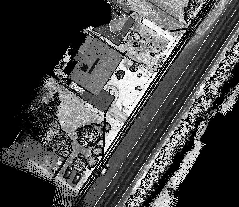
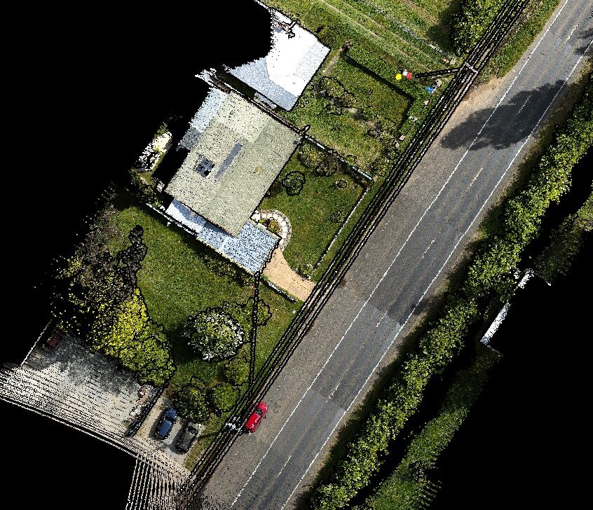

Realization.
At Hmara, we apply advanced GIS technologies to optimize power line design, minimizing risks and improving efficiency. Our expertise extends beyond sag analysis—check out our case study on 3D topographic extraction for power line corridors, where we tackled complex terrain challenges using automated geospatial solutions.
To implement the project for creating a site map and longitudinal section of the power transmission line, we used software for processing point cloud and geodetic data. Tools supporting LAS data were applied for accurate terrain representation, as well as for determining the elevations and distances between poles. We automate work stages to improve data accuracy and reduce processing time.
Stages:
1. Point cloud processing:
The team started by processing laser scanning data to obtain accurate pole coordinates and determine their location. The main focus was on classifying ground, low points, electric poles, and the power transmission line. Laser scanner data were used to create a high-precision terrain model.
2. Sitemap creating:
Next, we created the terrain map, marking each pole with corresponding numbers and coordinates, and displaying the central wire route to calculate distances and ensure proper clearance between line elements.
3. Building Longitudinal Section:
In the next stage, longitudinal sections of the line were created, including the absolute and relative pole heights, the height from the crossarm to the top of the pole, temperature data, and distances between poles. This allowed us to define exact parameters for installation and future maintenance. We also included temperature data, as it is needed by engineers to correlate with the sag of the power transmission lines.
4. Determining Distances and Parameters:
After that, we performed an accurate check of distances between poles (chainages) and elevation parameters for each line element. Colored markings were used for easy identification and precise boundary determination.
5. Final Check and Documentation:
In the final stage, the team conducted a check of all data and corrected any possible inaccuracies. All the data were then compiled into a single file and provided to the client in a convenient format (DXF) for further use in the construction (or analysis) and maintenance of the power transmission line.
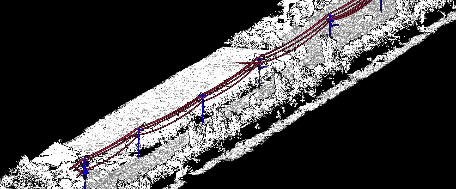

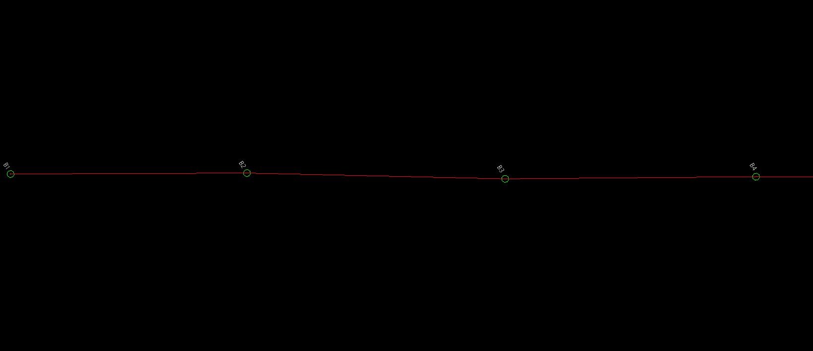

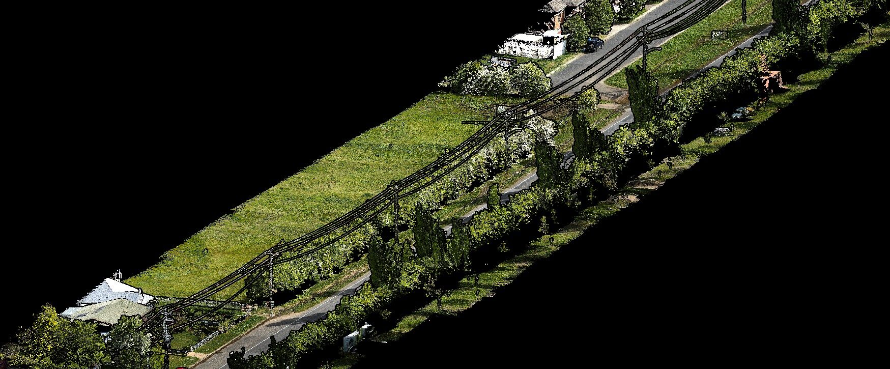

Accurate feature extraction plays a crucial role in power line infrastructure projects. By utilizing advanced GIS and remote sensing techniques, we efficiently identify and classify key elements such as poles, conductors, insulators, and surrounding terrain features. This enables precise sag analysis, clearance assessment, and structural optimization.
Our expertise extends beyond feature extraction and we also specialize in 3D planimetrics for power line corridors, ensuring seamless integration of extracted data into digital twins and BIM workflows. By combining automation with geospatial intelligence, we enhance efficiency, reduce manual labor, and improve decision-making for large-scale transmission projects.

Result.
As part of the project execution, we created a detailed site map, accurately reflecting the location of all power transmission line poles, including their coordinates and numbers. This significantly facilitates the installation process and future maintenance.
Additionally, longitudinal sections of the power transmission line were prepared, containing information about the base elevation of the poles, crossarms, and profiles of the structures. This provides an accurate representation of the vertical parameters of the line, which is critical for its safe and efficient installation.
The calculation of distances between poles, as well as the height and clearance parameters of the wires, enabled project optimization in full compliance with safety standards. The application of advanced point cloud processing technologies helped minimize potential errors and inaccuracies in the data.
All obtained materials, including maps, sections, and analytical calculations, were compiled into a convenient documentation package and delivered to the client in a ready-to-use format. This ensures that the installation and operation of the power transmission line can be carried out as efficiently as possible, reducing the risk of additional costs for corrections.
If required, we can also conduct surveys in any location, ensuring high data accuracy for further analysis.
We are always open to new challenges and collaborations. If you have similar projects or any questions, feel free to reach out to discuss potential cooperation opportunities.